

 Back
hike
Back
hike
Aussois Rake walking trail
Reach the "3,000" mark, with a panoramic view of high mountain peaks, so close it feels like you could reach out and touch them. Râteau d'Aussois is a summit that's accessible enough, provided you're sure-footed. At the end of your ascent, be prepared for the presence of late snow patches until July.
Description
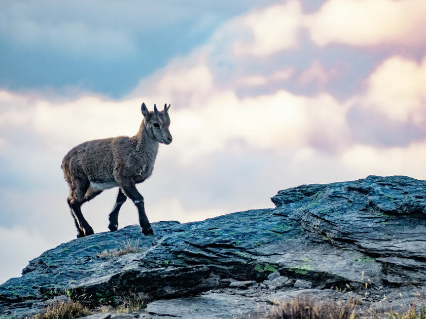
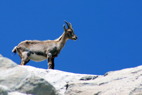
The majority of the circuit passes through a busy and perfectly marked path. You'll reach the Col de la Masse at 2,923 m without difficulty. If you're lucky, you might even come across "étagnes", female ibexes, accompanied by their adorable young, known here as "éterlous". From cairn to cairn, make your way between the boulders as you tackle the last ascent. The view awaiting is unforgettable - and well-deserved! What that 4,810-metre-tall you can see in the distance? After a moment of contemplation at the highest point, your next reward
appears: Plateau du Mauvais Berger. The marmots have set up a base camp here. Look at them fooling around among the blueberries and rhododenrons. Before reaching the Col du Barbier, picture how the plateau would look in autumn, all decked out in flamboyant colours. Now, that's a sight worth seeing! With your mind already filled with precious memories, take your time walking back to the well-marked GR® trail southwards. You're still feeling full of energy, and you make light of the descent, back towards Plan d'Aval. Let's go! One last push and you'll deserve a hero's welcome at Plan d'Amont.
Additional welcome
The duration of hiking trails is calculated using reference paces: 300 m/h ascent, 500 m/h descent and 4 km/h on the flat.
As hazards may occur at any time on the routes, the GPX tracks provided are not contractual. They are given for information only. Riders use them at their own risk, depending on their level of technological proficiency and their understanding of the terrain.
-
Minimum age: 14
Environments
-
 Lake view
-
Mountain view
-
Mountain location
-
In a nature reserve
-
Presence of livestock and guard dogs
Rates
Free access.
Itinerary
-
 Distance
15.5km
Distance
15.5km
-
 Route type
LOOP
Route type
LOOP
-
 Elevation gain
1250m
Elevation gain
1250m
-
 Negative gradient
1250m
Negative gradient
1250m
-
 Daily duration
07h00
Daily duration
07h00
-
 Signposted itinerary
Yes
Signposted itinerary
Yes
-
 Beaconing accuracy
Mixed markings (PR: yellow blades, PNV: blue-white-red and GR: red and white)
Beaconing accuracy
Mixed markings (PR: yellow blades, PNV: blue-white-red and GR: red and white)
-
 Nature of the land
Stone,
Not suitable for strollers
Nature of the land
Stone,
Not suitable for strollers
-
 Maximum altitude
3128m
Maximum altitude
3128m
Opening period
From 15/05 to 15/10 daily.
Subject to favorable snow and weather conditions.
Additional opening
-
Subject to favorable weather
-
Subject to snow conditions
Documents

Animals
Pets allowed : No
Pets are not allowed on this hike in the Vanoise National Park.
Guidebook with maps/step-by-step
-
To guide you in the field, consult the "step-by-step" directional diagram provided in pdf.


-
Distance
15.5km
-
Daily duration
07h00
-
Elevation gain
1250m
-
Negative gradient
1250m


-
Aussois
 cultural heritage
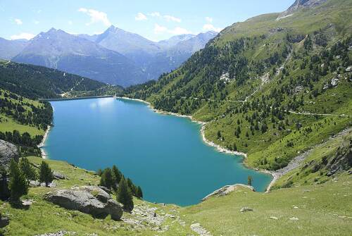
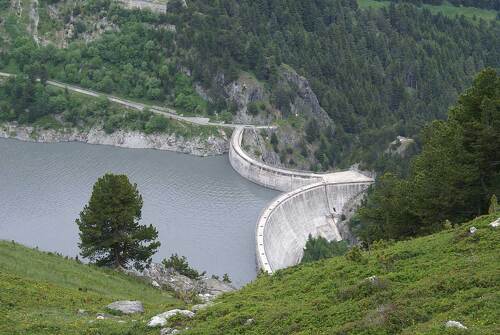
Dams of Plan d'Amont and Plan d'Aval
- 20th C
-
Aussois
 trade and service
Quarry car park
-
Aussois
 natural heritage
Vanoise National Park
- Mountain
- Peak
- Glacier
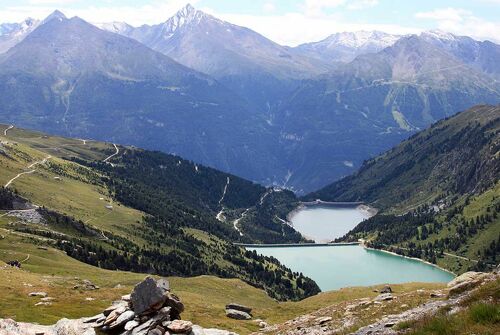
- Mountain lake
-
Aussois
 natural heritage
Lake Plan d'Amont Savoie - Alpes Va...
- Mountain lake
-
Aussois
 natural heritage
Plan d'Aval lake
- Mountain lake