Back
hike
Back
hike
Hiking to the Fond d'Aussois refuge
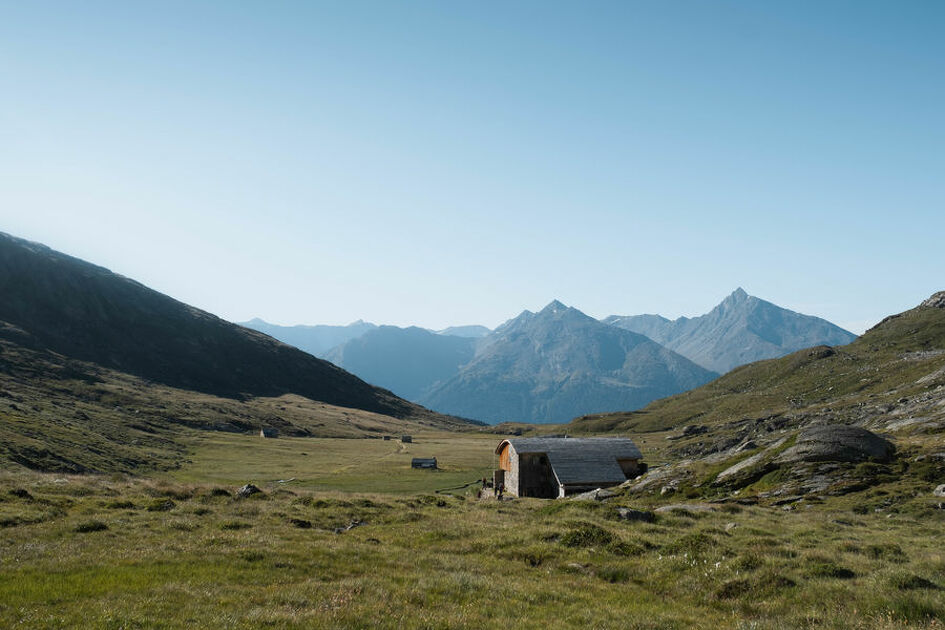
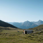
This introductory hike at the heart of Vanoise National Park is sure to leave you eager for more. Among the high-altitude landscapes, it leads you to the Fond d'Aussois plateau and the refuge that humbly awaits you.
Description
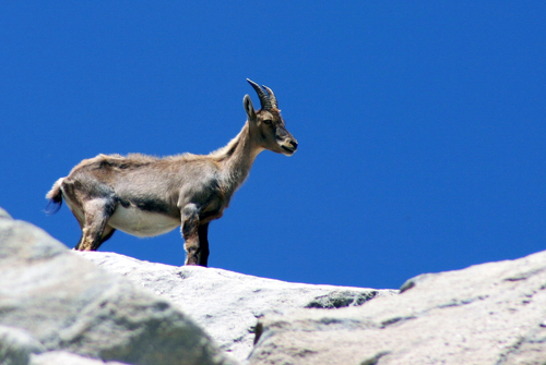
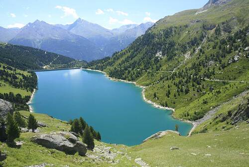
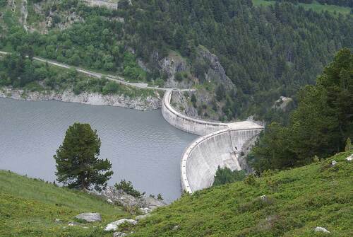
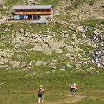
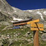
Did you know that the water basin you're passing by and its twin below, serve a particular purpose? They're part of the hydroelectric dam system powering the ONERA plant further down the valley. But now, your thoughts are distracted by the rhododendrons that line the path and the delightful scent of resin emanating from the Arolla pines. This little paradise is home to many animals: marmots, squirrels, bearded vultures, ibexes... You'll come across at least one of them. You come out of the trees onto a plain, through which the tranquil Saint-Antoine stream meanders. Follow it to the gorgeous Notre-Dame-des-Anges chapel. A few choughs soar up above; they seem to be guarding the place. At last, you reach the refuge, overlooking the former "Chalet de la Marie". Tim's warm welcome and the organic local food will certainly encourage you to make a stop. For the more adventurous, the hike continues on a slightly steeper slope towards Col d'Aussois. But your efforts will be handsomely rewarded by a breathtaking view of the Dent Parrachée, patched with snow.
Additional welcome
The duration of hiking trails is calculated using reference paces: 300 m/h ascent, 500 m/h descent and 4 km/h on the flat.
As hazards may occur at any time on the routes, the GPX tracks provided are not contractual. They are given for information only. Riders use them at their own risk, depending on their level of technological proficiency and their understanding of the terrain.
-
Minimum age: 10 years
Environments
-
 Lake view
-
Mountain view
-
Mountain location
-
In a nature reserve
-
Presence of livestock and guard dogs
Rates
Free access.
Itinerary
-
 Distance
8.8km
Distance
8.8km
-
 Route type
Round trip
Route type
Round trip
-
 Elevation gain
320m
Elevation gain
320m
-
 Negative gradient
320m
Negative gradient
320m
-
 Daily duration
03h00
Daily duration
03h00
-
 Signposted itinerary
Yes
Signposted itinerary
Yes
-
 Beaconing accuracy
Mixed markings (PR: yellow blades, PNV: blue-white-red and GR: red and white)
Beaconing accuracy
Mixed markings (PR: yellow blades, PNV: blue-white-red and GR: red and white)
-
 Nature of the land
Rock,
Stone,
Ground,
Not suitable for strollers
Nature of the land
Rock,
Stone,
Ground,
Not suitable for strollers
-
 Maximum altitude
2346m
Maximum altitude
2346m
Opening period
Daily from June 1 to October 15.
Subject to favorable snow and weather conditions.
Additional opening
-
Subject to favorable weather
-
Subject to snow conditions
Documents

Animals
Pets allowed : No
Out of respect for wildlife, please keep your dog on a lead.
Guidebook with maps/step-by-step
-
To guide you in the field, consult the "step-by-step" directional diagram provided in pdf.


-
Distance
8.8km
-
Daily duration
03h00
-
Elevation gain
320m
-
Negative gradient
320m